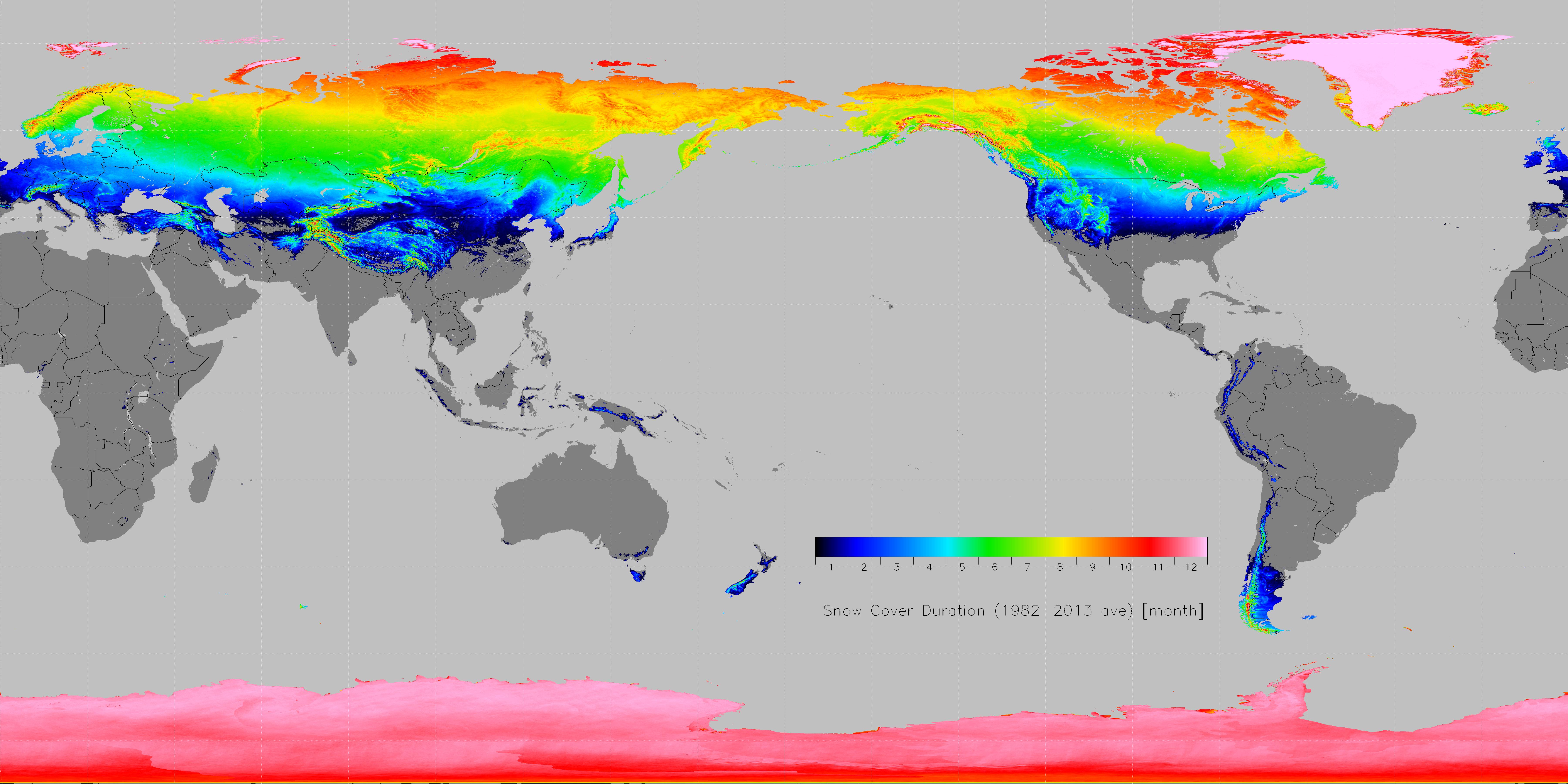
Data descriptions:
Global 0.05 × 0.05 deg gridded snow cover duration data. Data type is binary (data type: uint8). A netcdf4 file is also available storing scd of float type.
Array size: 7200 x 3601 (equal lon-lat grid same as the JASMES grid, https://www.eorc.jaxa.jp/JASMES/docs/CSF_gl_data.html)
Size of pixel: 0.05 degree (same as grid interval)
Latitude and longitude of four corners of the global image (center of each corner pixel):
Upper left: Lon: 0.0deg.E, Lat: 90.0deg.N
Lower right: Lon: 359.95deg.E (-0.05deg.W), Lat: 90.0deg.S
Meaning of values:
0-240: snow cover duration counted as the number of half-months x 10.
"240" means that the pixel is covered with snow during the whole year (24 half-months).)
250: ocean without snow cover
251: land without snow cover
255: fill value
The detailed analysis method and accuracy estimations of snow cover detection are found in Hori et al. (2017).
| Coverage | Spatial resol. | Period (click to download data) | Format | Satellite Sensors | Notes |
| Global | 0.05 deg. | Jan. 1982 - Dec. 2013 | binary | AVHRR, MODIS | snow cover duration |
| Global | 0.05 deg. | Jan. 1982 - Dec. 2013 | netcdf | AVHRR, MODIS | snow cover duration |